Glacier Bay National Park & Preserve
Covering 3.3 million acres of rugged mountains, dynamic glaciers, temperate rainforest, wild coastlines and deep sheltered fjords, Glacier Bay National Park is a highlight of Alaska's Inside Passage and part of a 25-million acre World Heritage Site—one of the world’s largest international protected areas. From sea to summit, Glacier Bay offers limitless opportunities for adventure and inspiration.
Map showing location of park.
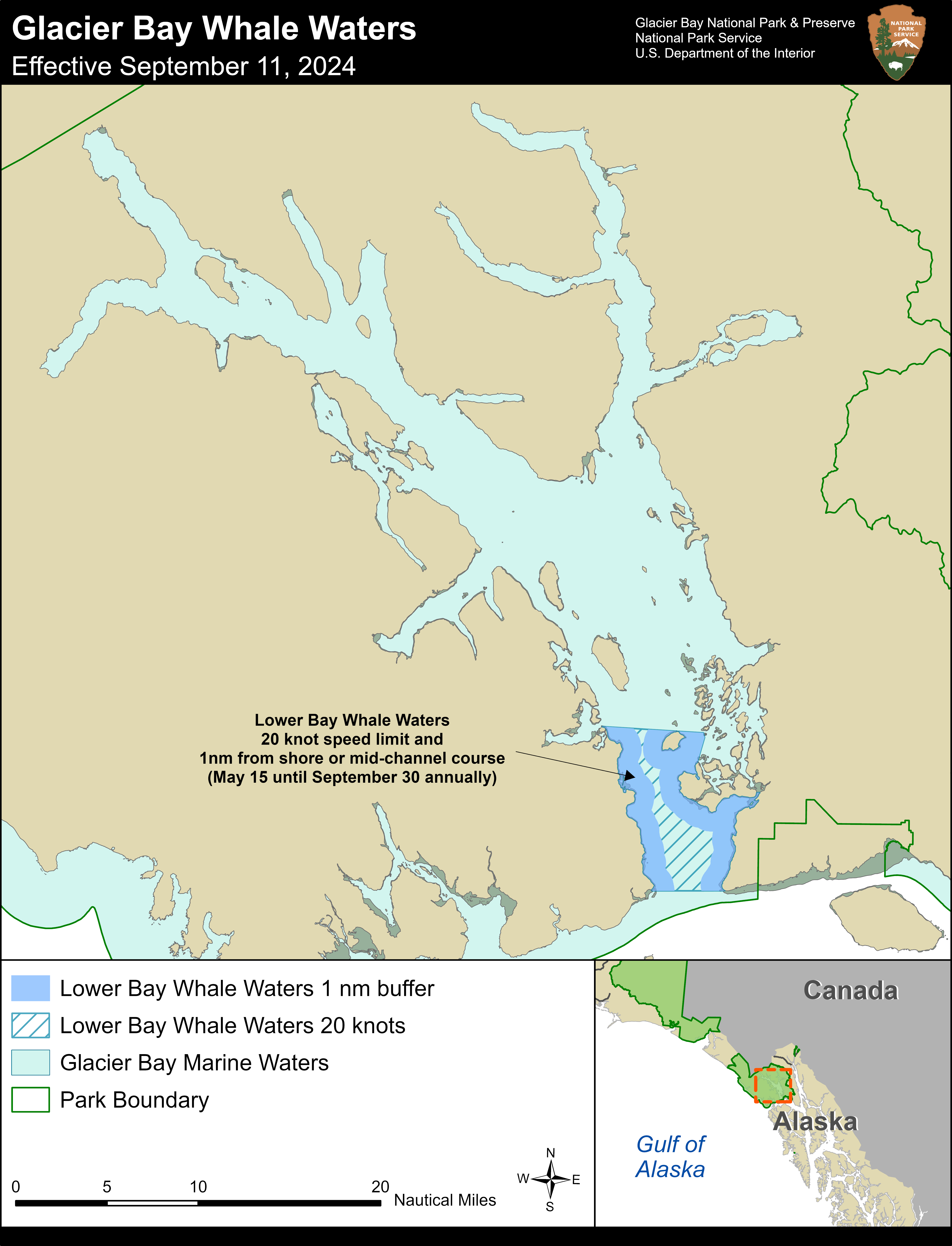
Whale Waters Update for Glacier Bay Effective Sept. 11, 2024
Glacier Bay National Park announced today that the 13-knot vessel speed limit near Sturgess Island, North Marble Island, South Marble Island, and in the eastern portions of Lower Bay whale waters will be removed effective September 11, 2024 at 5AM, as humpback whales are no longer concentrating in those areas. Lower Bay 20-knot whale waters remain in effect through Sept. 30.
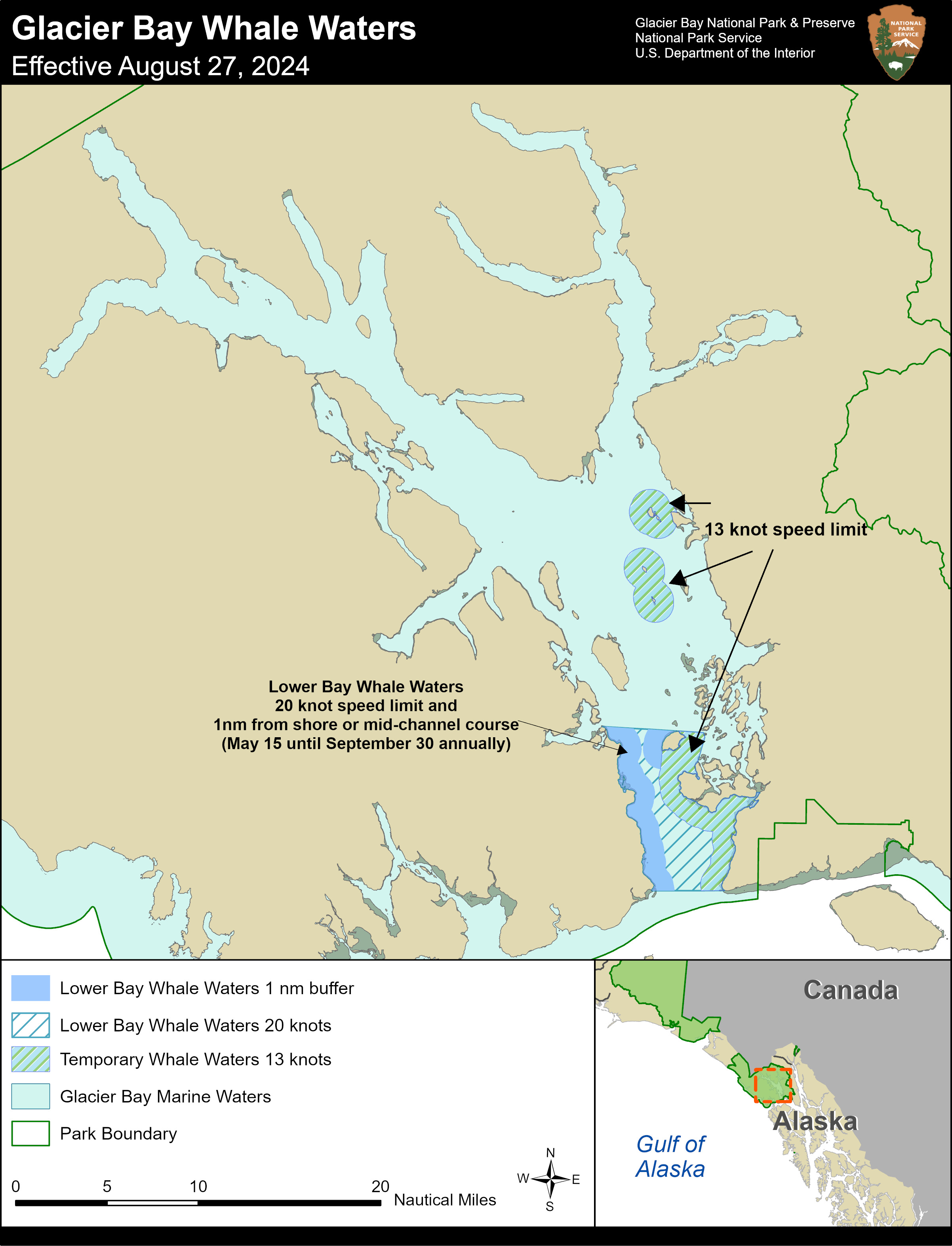
Whale Waters Update for Glacier Bay Effective July 16, 2024
Glacier Bay Acting Deputy Superintendent Joni Seay announced today that modified temporary whale waters are being implemented near the Marble Islands in Glacier Bay.
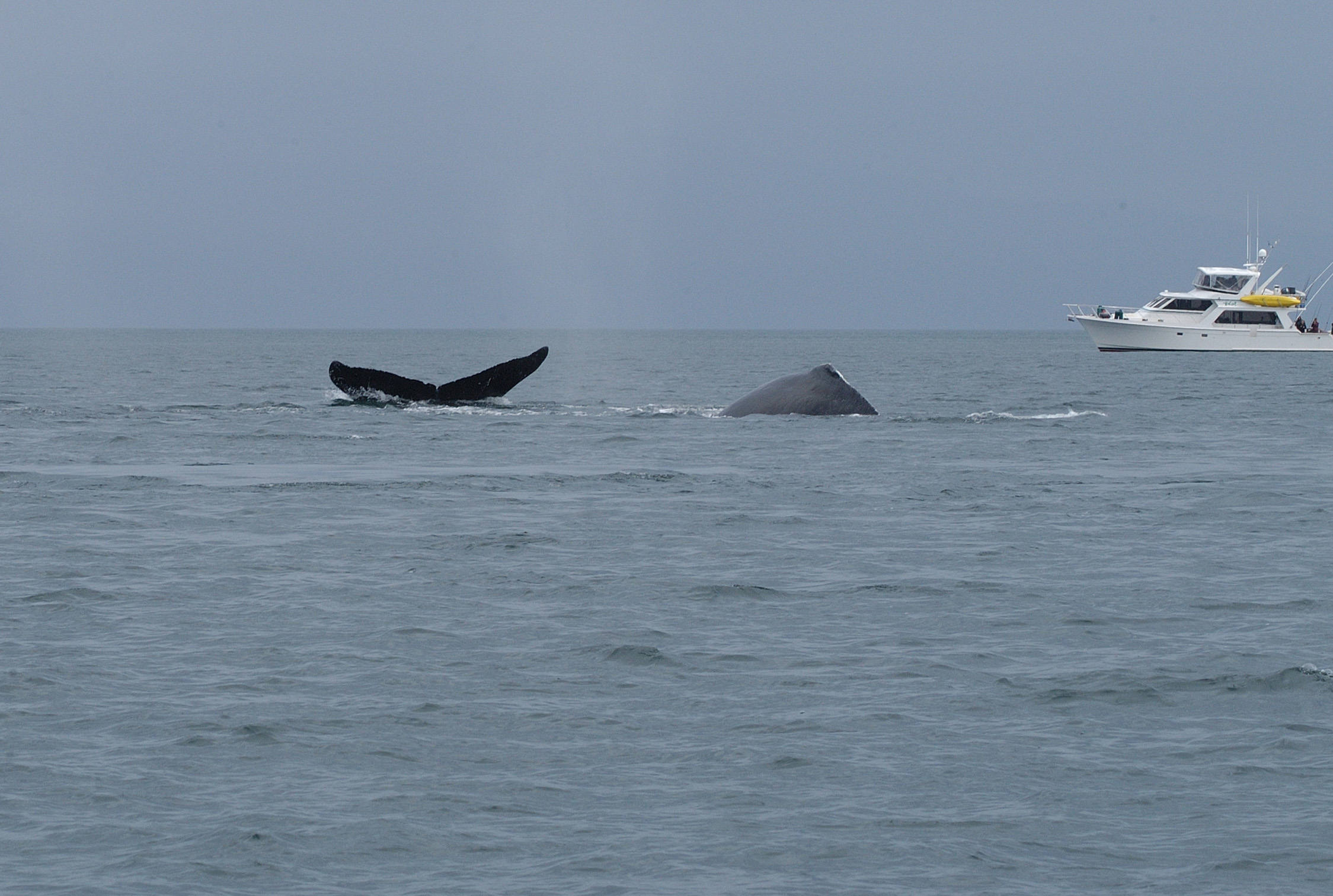
Glacier Bay Supports Efforts to Prevent Whale Strikes
Humpback whales thrive in the marine ecosystem of Glacier Bay National Park. Learn more about recent area whale strikes and what actions boaters must take to avoid them.
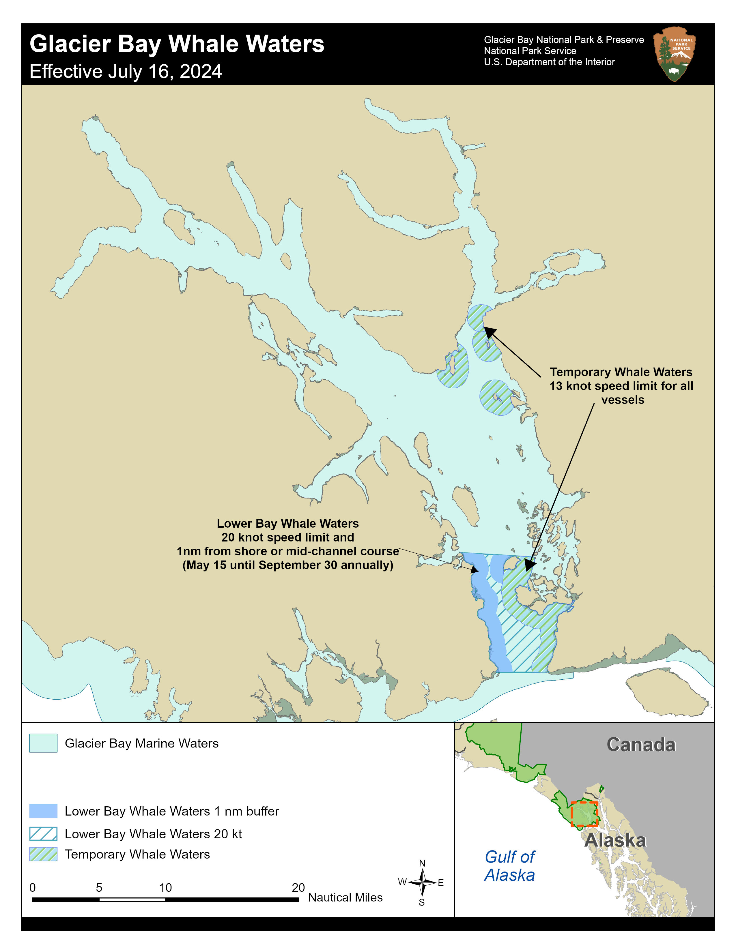
Whale Waters Update for Glacier Bay Effective July 16, 2024
Glacier Bay National Park and Preserve Superintendent Tom Schaff announced today that modified temporary whale waters are being implemented near the mouth of the East Arm.
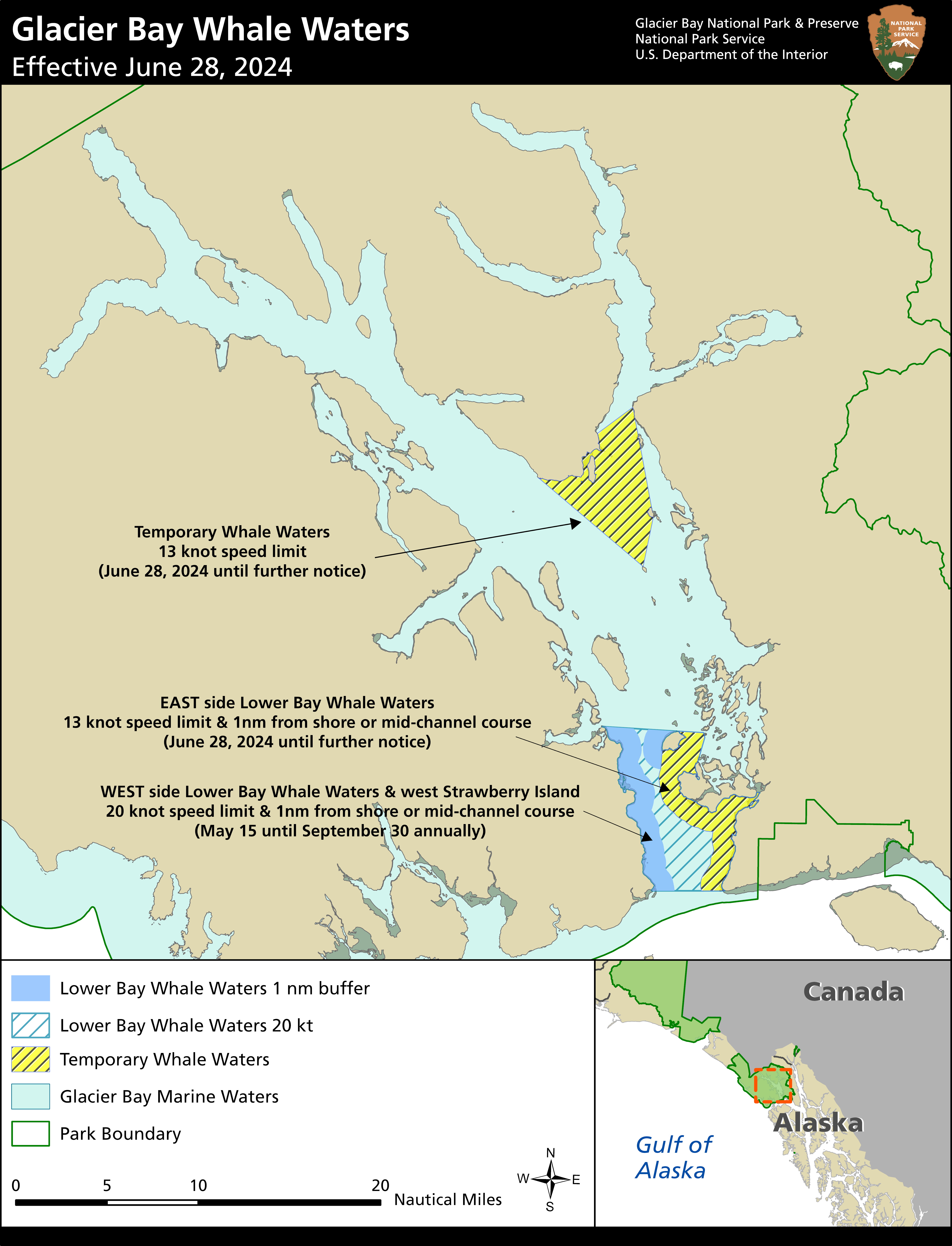
Whale Waters Update for Glacier Bay Effective June 28, 2024
Glacier Bay National Park and Preserve Superintendent Tom Schaff announced today that a 13-knot vessel speed limit is being implemented in the eastern portion of Lower Bay whale waters. These updated operating requirements are effective from 5 AM Friday June 28th until further notice.
Photo by NPS / T. VandenBerg
Photo by NPS Photo
Photo by NPS Photo / B. Whitehead
Photo by NPS Photo / C. Behnke
Photo by NPS Photo
Photo by NPS photo