Pictured Rocks National Lakeshore
Sandstone cliffs, beaches, waterfalls, sand dunes, inland lakes, deep forest, and wild shoreline beckon you to visit Pictured Rocks National Lakeshore. The power of Lake Superior shapes the park's coastal features and affects every ecosystem, creating a unique landscape to explore. Hiking, camping, sightseeing, and four-season outdoor opportunities abound.
Map showing location of park.
Body Recovered from Lake Superior at Chapel Beach
On the afternoon of July 3, 2025, a deceased individual was recovered from Lake Superior near Chapel Beach within Pictured Rocks National Lakeshore.

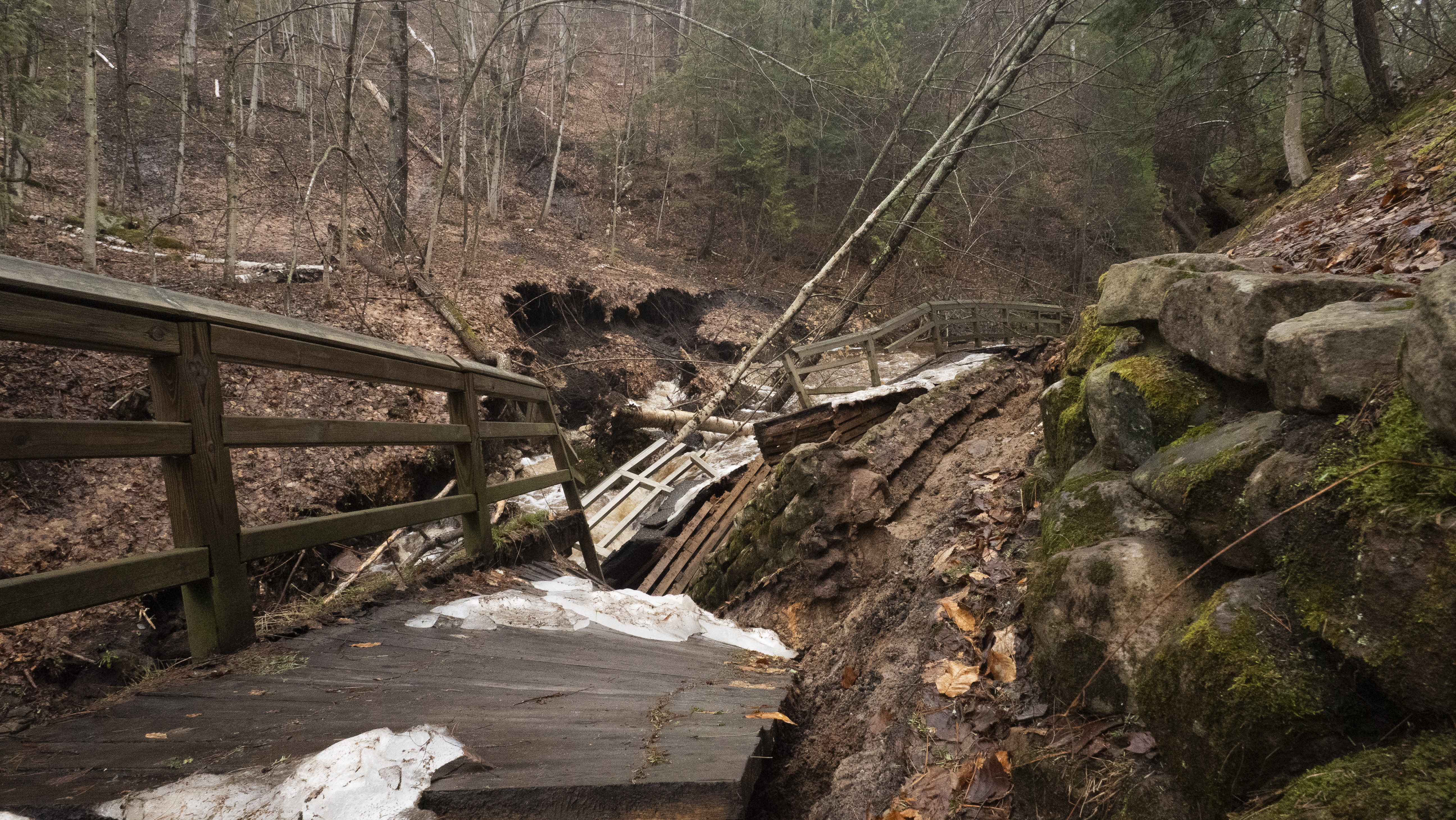
Munising Falls Trail Closed Until Further Notice
The Munising Falls Trail in Pictured Rocks National Lakeshore is closed until further notice. A 75-foot section of the paved trail was washed out during a storm on the evening of April 28th. There is no viewing access to Munising Falls. Travel within the closure is prohibited.
Photo by NPS Photo
Photo by NPS Photo
Photo by NPS Photos
Photo by NPS Photo
Photo by NPS Photos
Photo by NPS Photos
Photo by NPS Photo
Photo by NPS Photo
Photo by NPS Photo
Photo by NPS Photos