Sunset Crater Volcano National Monument
The lava flow lies on the land like a dream, a wonderland of rock. A thousand years ago the ground was torn open and lava erupted into the sky, forever changing the landscape and the lives of the people who lived here. A thousand years later, trees and flowers grow among the rocks, and people visit the lava flow to see and remember the most recent volcanic eruption in Arizona.
Map showing location of park.

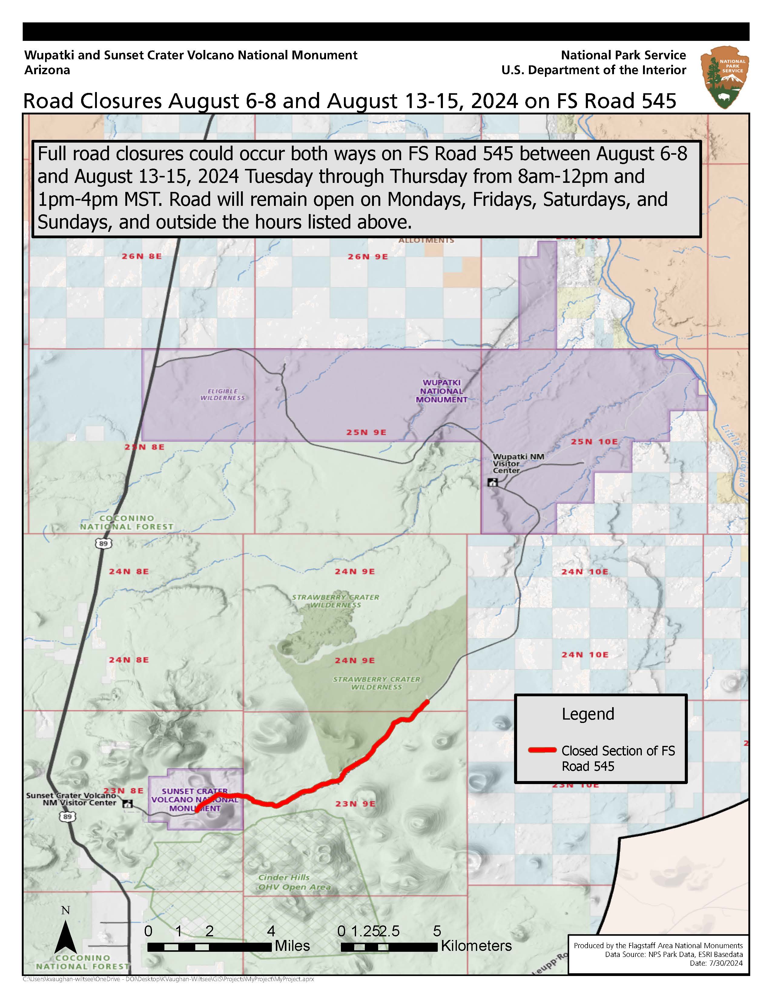
FS Road 545 Road Closure
multi-hour closures on FS Rd545 connecting Wupatki and Sunset Crater Volcano National Monuments Aug 6-8, & Aug 13-15 from 8am-12pm and 1pm-4pm past the Lava Flow Trail to milepost 12.
Road Closure Aug 6-8 and Aug 13–15 2024 on FS Road 545 (Loop Road) in & near Sunset Crater Volcano Nat’l Monument
Forest Service Road 545 (also known as the Loop Road), which connects Sunset Crater Volcano and Wupatki National Monuments, will have periodic multi-hour closures starting Tue Aug 6. These closures are necessary for the safe removal of remaining hazard trees from the 2022 Tunnel and Pipeline Fires.
Photo by NPS Photo / Elliot Schultz
Photo by NPS Photo / Elliot Schultz
Photo by NPS Photo / Elliot Schultz
Photo by NPS Photo / Elliot Schultz
Photo by NPS Photo / Elliot Schultz
Photo by NPS / Owen Ellis
Photo by NPS / Owen Ellis